Course Features
Price
Study Method
Online | Self-paced
Course Format
Interactive PDFs, Articles & Learning Resources
Duration
6 hours, 55 minutes
Qualification
Professional Skills Development Course
Assessment
Final MCQ Exam (included in price)
Certificate
Verifiable Digital Certificate - Free
Additional info
Lifetime Access | Start Instantly
- Share
Overview
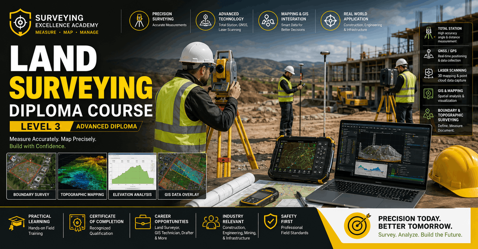
Land Surveying is a fundamental discipline in construction, engineering, mapping, and land development, focused on accurately measuring and representing the physical features of land. This Level 3 Advanced Diploma is designed to provide learners with a comprehensive understanding of modern surveying principles, tools, techniques, and legal frameworks used in the UK and international contexts.
Throughout this course, learners will explore the core principles of land surveying, including its history, importance, and professional responsibilities of a surveyor. You will gain an understanding of different types of surveys such as topographic, cadastral, and engineering surveys, along with their real-world applications in construction and land development projects.
The course provides in-depth training on essential surveying instruments and technologies. Learners will study total stations, GNSS and GPS systems, laser scanners, theodolites, and digital surveying tools. You will also gain insight into modern innovations shaping the future of surveying, including data-driven mapping and digital field technologies.
A strong focus is placed on measurement techniques and field procedures. Learners will develop practical knowledge of linear and angular measurements, levelling methods, traversing, boundary surveys, and control surveys. These skills are essential for ensuring accuracy, precision, and reliability in all surveying operations.
The programme also covers surveying data collection, recording, and management techniques. You will learn how to handle field notes, digital data systems, surveying software, and quality control processes. Additionally, the course introduces surveying calculations, coordinate systems, map projections, and error correction methods used to ensure accurate results.
Legal and regulatory knowledge is another key component of this course. Learners will explore UK land laws, property boundaries, health and safety requirements, ethical considerations, and professional surveying standards. Practical applications such as GIS mapping, construction setting out, and survey reporting are also included to strengthen real-world competence.
By completing this course, learners will develop strong technical, analytical, and field-based skills required for professional surveying roles.
Learners who successfully complete this course will receive a free course completion certificate. Multiple premium certificate and transcript options are also available for purchase. Students will benefit from 5-star rated support available 24/7 via email.Who is this course for?
Land Surveying is a fundamental discipline in construction, engineering, mapping, and land development, focused on accurately measuring and representing the physical features of land. This Level 3 Advanced Diploma is designed to provide learners with a comprehensive understanding of modern surveying principles, tools, techniques, and legal frameworks used in the UK and international contexts.
Throughout this course, learners will explore the core principles of land surveying, including its history, importance, and professional responsibilities of a surveyor. You will gain an understanding of different types of surveys such as topographic, cadastral, and engineering surveys, along with their real-world applications in construction and land development projects.
The course provides in-depth training on essential surveying instruments and technologies. Learners will study total stations, GNSS and GPS systems, laser scanners, theodolites, and digital surveying tools. You will also gain insight into modern innovations shaping the future of surveying, including data-driven mapping and digital field technologies.
A strong focus is placed on measurement techniques and field procedures. Learners will develop practical knowledge of linear and angular measurements, levelling methods, traversing, boundary surveys, and control surveys. These skills are essential for ensuring accuracy, precision, and reliability in all surveying operations.
The programme also covers surveying data collection, recording, and management techniques. You will learn how to handle field notes, digital data systems, surveying software, and quality control processes. Additionally, the course introduces surveying calculations, coordinate systems, map projections, and error correction methods used to ensure accurate results.
Legal and regulatory knowledge is another key component of this course. Learners will explore UK land laws, property boundaries, health and safety requirements, ethical considerations, and professional surveying standards. Practical applications such as GIS mapping, construction setting out, and survey reporting are also included to strengthen real-world competence.
By completing this course, learners will develop strong technical, analytical, and field-based skills required for professional surveying roles.
Learners who successfully complete this course will receive a free course completion certificate. Multiple premium certificate and transcript options are also available for purchase. Students will benefit from 5-star rated support available 24/7 via email.Requirements
Land Surveying is a fundamental discipline in construction, engineering, mapping, and land development, focused on accurately measuring and representing the physical features of land. This Level 3 Advanced Diploma is designed to provide learners with a comprehensive understanding of modern surveying principles, tools, techniques, and legal frameworks used in the UK and international contexts.
Throughout this course, learners will explore the core principles of land surveying, including its history, importance, and professional responsibilities of a surveyor. You will gain an understanding of different types of surveys such as topographic, cadastral, and engineering surveys, along with their real-world applications in construction and land development projects.
The course provides in-depth training on essential surveying instruments and technologies. Learners will study total stations, GNSS and GPS systems, laser scanners, theodolites, and digital surveying tools. You will also gain insight into modern innovations shaping the future of surveying, including data-driven mapping and digital field technologies.
A strong focus is placed on measurement techniques and field procedures. Learners will develop practical knowledge of linear and angular measurements, levelling methods, traversing, boundary surveys, and control surveys. These skills are essential for ensuring accuracy, precision, and reliability in all surveying operations.
The programme also covers surveying data collection, recording, and management techniques. You will learn how to handle field notes, digital data systems, surveying software, and quality control processes. Additionally, the course introduces surveying calculations, coordinate systems, map projections, and error correction methods used to ensure accurate results.
Legal and regulatory knowledge is another key component of this course. Learners will explore UK land laws, property boundaries, health and safety requirements, ethical considerations, and professional surveying standards. Practical applications such as GIS mapping, construction setting out, and survey reporting are also included to strengthen real-world competence.
By completing this course, learners will develop strong technical, analytical, and field-based skills required for professional surveying roles.
Learners who successfully complete this course will receive a free course completion certificate. Multiple premium certificate and transcript options are also available for purchase. Students will benefit from 5-star rated support available 24/7 via email.Career path
Land Surveying is a fundamental discipline in construction, engineering, mapping, and land development, focused on accurately measuring and representing the physical features of land. This Level 3 Advanced Diploma is designed to provide learners with a comprehensive understanding of modern surveying principles, tools, techniques, and legal frameworks used in the UK and international contexts.
Throughout this course, learners will explore the core principles of land surveying, including its history, importance, and professional responsibilities of a surveyor. You will gain an understanding of different types of surveys such as topographic, cadastral, and engineering surveys, along with their real-world applications in construction and land development projects.
The course provides in-depth training on essential surveying instruments and technologies. Learners will study total stations, GNSS and GPS systems, laser scanners, theodolites, and digital surveying tools. You will also gain insight into modern innovations shaping the future of surveying, including data-driven mapping and digital field technologies.
A strong focus is placed on measurement techniques and field procedures. Learners will develop practical knowledge of linear and angular measurements, levelling methods, traversing, boundary surveys, and control surveys. These skills are essential for ensuring accuracy, precision, and reliability in all surveying operations.
The programme also covers surveying data collection, recording, and management techniques. You will learn how to handle field notes, digital data systems, surveying software, and quality control processes. Additionally, the course introduces surveying calculations, coordinate systems, map projections, and error correction methods used to ensure accurate results.
Legal and regulatory knowledge is another key component of this course. Learners will explore UK land laws, property boundaries, health and safety requirements, ethical considerations, and professional surveying standards. Practical applications such as GIS mapping, construction setting out, and survey reporting are also included to strengthen real-world competence.
By completing this course, learners will develop strong technical, analytical, and field-based skills required for professional surveying roles.
Learners who successfully complete this course will receive a free course completion certificate. Multiple premium certificate and transcript options are also available for purchase. Students will benefit from 5-star rated support available 24/7 via email.-
- Overview of Land Surveying and Its Importance 00:10:00
- History and Development of Surveying in the UK 00:10:00
- Roles and Responsibilities of a Land Surveyor 00:10:00
- Types of Surveys (Topographic, Cadastral, Engineering, etc.) 00:10:00
- Health, Safety, and Environmental Considerations in Surveying 00:10:00
-
- Introduction to Surveying Instruments 00:10:00
- Use and Care of Total Stations 00:10:00
- Global Navigation Satellite Systems (GNSS) & GPS in Surveying 00:10:00
- Levels, Theodolites, and Laser Scanners 00:10:00
- Modern Surveying Technologies and Innovations 00:10:00
- Linear and Angular Measurement Fundamentals 00:10:00
- Levelling Procedures and Height Measurement 00:10:00
- Traversing and Boundary Survey Techniques 00:10:00
- Setting Out and Control Surveys 00:10:00
- Error Analysis and Accuracy in Surveying 00:10:00
- Basic Surveying Calculations (Distances, Angles) 00:10:00
- Coordinate Systems and Map Projections in the UK 00:10:00
- Adjustments for Traverse and Levelling Data 00:10:00
- Error Correction Methods 00:10:00
- Preparing Survey Reports and Plans 00:10:00
- Conducting a Topographic Survey 00:10:00
- Boundary and Cadastral Survey Project 00:10:00
- Setting Out for Construction Projects 00:10:00
- Use of GIS in Surveying 00:10:00
- Preparing Final Survey Reports and Presentations 00:10:00
- Premium Certificate 00:15:00

No Reviews found for this course.
Is this certificate recognized?
Yes, our premium certificate and transcript are widely recognized and accepted by embassies worldwide, particularly by the UK embassy. This adds credibility to your qualification and enhances its value for professional and academic purposes.
I am a beginner. Is this course suitable for me?
Yes, this course is designed for learners of all levels, including beginners. The content is structured to provide step-by-step guidance, ensuring that even those with no prior experience can follow along and gain valuable knowledge.
I am a professional. Is this course suitable for me?
Yes, professionals will also benefit from this course. It covers advanced concepts, practical applications, and industry insights that can help enhance existing skills and knowledge. Whether you are looking to refine your expertise or expand your qualifications, this course provides valuable learning.
Does this course have an expiry date?
No, you have lifetime access to the course. Once enrolled, you can revisit the materials at any time as long as the course remains available. Additionally, we regularly update our content to ensure it stays relevant and up to date.
How do I claim my free certificate?
I trust you’re in good health. Your free certificate can be located in the Achievement section. The option to purchase a CPD certificate is available but entirely optional, and you may choose to skip it. Please be aware that it’s crucial to click the “Complete” button to ensure the certificate is generated, as this process is entirely automated.
Does this course have assessments and assignments?
Yes, the course includes both assessments and assignments. Your final marks will be determined by a combination of 20% from assignments and 80% from assessments. These evaluations are designed to test your understanding and ensure you have grasped the key concepts effectively.
Is this course accredited?
We are a recognized course provider with CPD, UKRLP, and AOHT membership. The logos of these accreditation bodies will be featured on your premium certificate and transcript, ensuring credibility and professional recognition.
Will I receive a certificate upon completion?
Yes, you will receive a free digital certificate automatically once you complete the course. If you would like a premium CPD-accredited certificate, either in digital or physical format, you can upgrade for a small fee.
Course Features
Price
Study Method
Online | Self-paced
Course Format
Interactive PDFs, Articles & Learning Resources
Duration
6 hours, 55 minutes
Qualification
Professional Skills Development Course
Assessment
Final MCQ Exam (included in price)
Certificate
Verifiable Digital Certificate - Free
Additional info
Lifetime Access | Start Instantly
- Share

Pottery Level 3 Advanced Diploma
Course Line237€572.47Original price was: €572.47.€17.51Current price is: €17.51.Cryptocurrency Trading & Blockchain Insights for Traders
Course Line239€572.47Original price was: €572.47.€17.51Current price is: €17.51.Pay Equity and Fairness Level 3 Advanced Diploma
Course Line237€572.47Original price was: €572.47.€17.51Current price is: €17.51.


Related Courses
AutoCAD Floor Plan Rendering in Photoshop: Architectural Visualisation Professional Training
€572.47Original price was: €572.47.€17.51Current price is: €17.51.237Engineering Mathematics Level 5 Advanced Diploma
€572.47Original price was: €572.47.€17.51Current price is: €17.51.237Civil Engineering Building Construction Fundamentals: Site, Codes & Quantity Skills
€572.47Original price was: €572.47.€17.51Current price is: €17.51.2385