Course Features
Price
Study Method
Online | Self-paced
Course Format
Reading Material - PDF, article
Duration
2 hours, 46 minutes
Qualification
No formal qualification
Certificate
At completion
Additional info
Coming soon
- Share
Overview
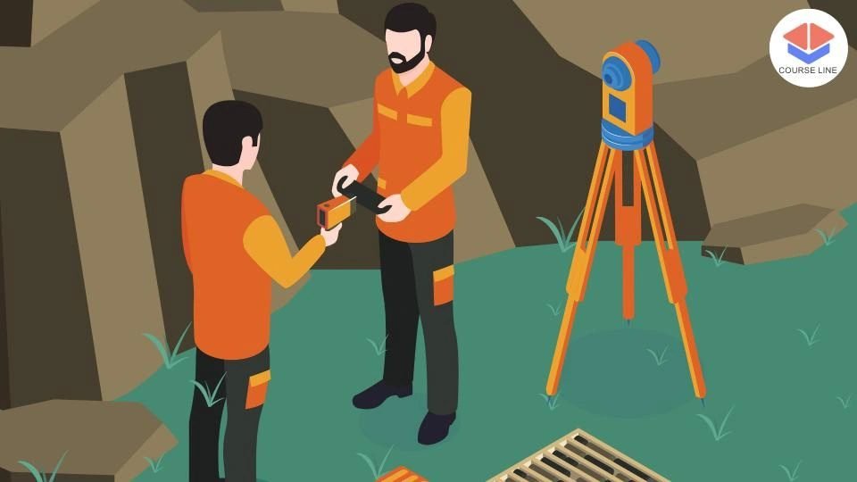
The Geodetic Surveying and Geodesy Level 3 Advanced Diploma offers an in-depth exploration of the science of measuring and understanding the Earth's geometric shape, orientation in space, and gravitational field. This advanced programme introduces learners to the foundational and practical aspects of geodetic surveying, equipping them with the skills necessary to carry out precise spatial measurements and geospatial analysis essential for infrastructure development, mapping, environmental monitoring, and scientific research.
The course begins with an introduction to geodesy, exploring the shape and size of the Earth and the principles that underpin geodetic measurements. Students learn how geodesy serves as the scientific foundation for all spatial data collection and mapping activities. The second module focuses on geodetic datums and coordinate systems, highlighting how global and local reference systems are used to accurately position points on the Earth's surface. Understanding these systems is crucial for ensuring consistency and precision in surveying tasks.
In the practical surveying module, learners explore classical techniques such as triangulation and trilateration, alongside modern geodetic methods involving Global Navigation Satellite Systems (GNSS). These lessons enable learners to collect high-precision data in diverse surveying contexts. Students will also gain knowledge in conducting GNSS-based surveys and interpreting satellite data to meet the needs of various engineering, construction, and environmental projects.
The course places a strong emphasis on data accuracy and reliability. A dedicated module on data analysis and adjustment introduces learners to the method of least squares adjustment, a statistical technique used to minimize errors in geodetic networks. In addition, students will learn how to analyse errors in geodetic observations to enhance the quality and integrity of their survey results.
In the final section, learners explore advanced geodetic applications, including monitoring Earth's dynamic changes—such as tectonic movements, sea level variation, and crustal deformation. They will also learn how to integrate geodetic data with Geographic Information Systems (GIS) to support advanced spatial analysis, mapping, and decision-making processes in real-world projects.
By the end of the programme, learners will have developed a strong theoretical foundation and practical skill set in geodetic surveying and geodesy, preparing them for both fieldwork and analytical roles in the geospatial industry.
This course is ideal for aspiring land surveyors, geospatial professionals, civil engineers, GIS technicians, and anyone interested in precision surveying and geodetic sciences. It is also suitable for students pursuing careers in geodesy, Earth observation, or spatial data analysis.
Who is this course for?
The Geodetic Surveying and Geodesy Level 3 Advanced Diploma offers an in-depth exploration of the science of measuring and understanding the Earth's geometric shape, orientation in space, and gravitational field. This advanced programme introduces learners to the foundational and practical aspects of geodetic surveying, equipping them with the skills necessary to carry out precise spatial measurements and geospatial analysis essential for infrastructure development, mapping, environmental monitoring, and scientific research.
The course begins with an introduction to geodesy, exploring the shape and size of the Earth and the principles that underpin geodetic measurements. Students learn how geodesy serves as the scientific foundation for all spatial data collection and mapping activities. The second module focuses on geodetic datums and coordinate systems, highlighting how global and local reference systems are used to accurately position points on the Earth's surface. Understanding these systems is crucial for ensuring consistency and precision in surveying tasks.
In the practical surveying module, learners explore classical techniques such as triangulation and trilateration, alongside modern geodetic methods involving Global Navigation Satellite Systems (GNSS). These lessons enable learners to collect high-precision data in diverse surveying contexts. Students will also gain knowledge in conducting GNSS-based surveys and interpreting satellite data to meet the needs of various engineering, construction, and environmental projects.
The course places a strong emphasis on data accuracy and reliability. A dedicated module on data analysis and adjustment introduces learners to the method of least squares adjustment, a statistical technique used to minimize errors in geodetic networks. In addition, students will learn how to analyse errors in geodetic observations to enhance the quality and integrity of their survey results.
In the final section, learners explore advanced geodetic applications, including monitoring Earth's dynamic changes—such as tectonic movements, sea level variation, and crustal deformation. They will also learn how to integrate geodetic data with Geographic Information Systems (GIS) to support advanced spatial analysis, mapping, and decision-making processes in real-world projects.
By the end of the programme, learners will have developed a strong theoretical foundation and practical skill set in geodetic surveying and geodesy, preparing them for both fieldwork and analytical roles in the geospatial industry.
This course is ideal for aspiring land surveyors, geospatial professionals, civil engineers, GIS technicians, and anyone interested in precision surveying and geodetic sciences. It is also suitable for students pursuing careers in geodesy, Earth observation, or spatial data analysis.
Requirements
The Geodetic Surveying and Geodesy Level 3 Advanced Diploma offers an in-depth exploration of the science of measuring and understanding the Earth's geometric shape, orientation in space, and gravitational field. This advanced programme introduces learners to the foundational and practical aspects of geodetic surveying, equipping them with the skills necessary to carry out precise spatial measurements and geospatial analysis essential for infrastructure development, mapping, environmental monitoring, and scientific research.
The course begins with an introduction to geodesy, exploring the shape and size of the Earth and the principles that underpin geodetic measurements. Students learn how geodesy serves as the scientific foundation for all spatial data collection and mapping activities. The second module focuses on geodetic datums and coordinate systems, highlighting how global and local reference systems are used to accurately position points on the Earth's surface. Understanding these systems is crucial for ensuring consistency and precision in surveying tasks.
In the practical surveying module, learners explore classical techniques such as triangulation and trilateration, alongside modern geodetic methods involving Global Navigation Satellite Systems (GNSS). These lessons enable learners to collect high-precision data in diverse surveying contexts. Students will also gain knowledge in conducting GNSS-based surveys and interpreting satellite data to meet the needs of various engineering, construction, and environmental projects.
The course places a strong emphasis on data accuracy and reliability. A dedicated module on data analysis and adjustment introduces learners to the method of least squares adjustment, a statistical technique used to minimize errors in geodetic networks. In addition, students will learn how to analyse errors in geodetic observations to enhance the quality and integrity of their survey results.
In the final section, learners explore advanced geodetic applications, including monitoring Earth's dynamic changes—such as tectonic movements, sea level variation, and crustal deformation. They will also learn how to integrate geodetic data with Geographic Information Systems (GIS) to support advanced spatial analysis, mapping, and decision-making processes in real-world projects.
By the end of the programme, learners will have developed a strong theoretical foundation and practical skill set in geodetic surveying and geodesy, preparing them for both fieldwork and analytical roles in the geospatial industry.
This course is ideal for aspiring land surveyors, geospatial professionals, civil engineers, GIS technicians, and anyone interested in precision surveying and geodetic sciences. It is also suitable for students pursuing careers in geodesy, Earth observation, or spatial data analysis.
Career path
The Geodetic Surveying and Geodesy Level 3 Advanced Diploma offers an in-depth exploration of the science of measuring and understanding the Earth's geometric shape, orientation in space, and gravitational field. This advanced programme introduces learners to the foundational and practical aspects of geodetic surveying, equipping them with the skills necessary to carry out precise spatial measurements and geospatial analysis essential for infrastructure development, mapping, environmental monitoring, and scientific research.
The course begins with an introduction to geodesy, exploring the shape and size of the Earth and the principles that underpin geodetic measurements. Students learn how geodesy serves as the scientific foundation for all spatial data collection and mapping activities. The second module focuses on geodetic datums and coordinate systems, highlighting how global and local reference systems are used to accurately position points on the Earth's surface. Understanding these systems is crucial for ensuring consistency and precision in surveying tasks.
In the practical surveying module, learners explore classical techniques such as triangulation and trilateration, alongside modern geodetic methods involving Global Navigation Satellite Systems (GNSS). These lessons enable learners to collect high-precision data in diverse surveying contexts. Students will also gain knowledge in conducting GNSS-based surveys and interpreting satellite data to meet the needs of various engineering, construction, and environmental projects.
The course places a strong emphasis on data accuracy and reliability. A dedicated module on data analysis and adjustment introduces learners to the method of least squares adjustment, a statistical technique used to minimize errors in geodetic networks. In addition, students will learn how to analyse errors in geodetic observations to enhance the quality and integrity of their survey results.
In the final section, learners explore advanced geodetic applications, including monitoring Earth's dynamic changes—such as tectonic movements, sea level variation, and crustal deformation. They will also learn how to integrate geodetic data with Geographic Information Systems (GIS) to support advanced spatial analysis, mapping, and decision-making processes in real-world projects.
By the end of the programme, learners will have developed a strong theoretical foundation and practical skill set in geodetic surveying and geodesy, preparing them for both fieldwork and analytical roles in the geospatial industry.
This course is ideal for aspiring land surveyors, geospatial professionals, civil engineers, GIS technicians, and anyone interested in precision surveying and geodetic sciences. It is also suitable for students pursuing careers in geodesy, Earth observation, or spatial data analysis.
-
- Overview of Geodesy 00:10:00
- Earth’s Shape and Size 00:11:00
-
- Geodetic Datums 00:10:00
- Coordinate Systems 00:10:00
- Triangulation and Trilateration 00:10:00
- GNSS Surveying 00:10:00
- Geodetic Monitoring of Earth’s Changes 00:10:00
- Integrating Geodetic Data with GIS 00:10:00
- Premium Certificate 00:15:00

Is this certificate recognized?
Yes, our premium certificate and transcript are widely recognized and accepted by embassies worldwide, particularly by the UK embassy. This adds credibility to your qualification and enhances its value for professional and academic purposes.
I am a beginner. Is this course suitable for me?
Yes, this course is designed for learners of all levels, including beginners. The content is structured to provide step-by-step guidance, ensuring that even those with no prior experience can follow along and gain valuable knowledge.
I am a professional. Is this course suitable for me?
Yes, professionals will also benefit from this course. It covers advanced concepts, practical applications, and industry insights that can help enhance existing skills and knowledge. Whether you are looking to refine your expertise or expand your qualifications, this course provides valuable learning.
Does this course have an expiry date?
No, you have lifetime access to the course. Once enrolled, you can revisit the materials at any time as long as the course remains available. Additionally, we regularly update our content to ensure it stays relevant and up to date.
How do I claim my free certificate?
I trust you’re in good health. Your free certificate can be located in the Achievement section. The option to purchase a CPD certificate is available but entirely optional, and you may choose to skip it. Please be aware that it’s crucial to click the “Complete” button to ensure the certificate is generated, as this process is entirely automated.
Does this course have assessments and assignments?
Yes, the course includes both assessments and assignments. Your final marks will be determined by a combination of 20% from assignments and 80% from assessments. These evaluations are designed to test your understanding and ensure you have grasped the key concepts effectively.
Is this course accredited?
We are a recognized course provider with CPD, UKRLP, and AOHT membership. The logos of these accreditation bodies will be featured on your premium certificate and transcript, ensuring credibility and professional recognition.
Will I receive a certificate upon completion?
Yes, you will receive a free digital certificate automatically once you complete the course. If you would like a premium CPD-accredited certificate, either in digital or physical format, you can upgrade for a small fee.
Course Features
Price
Study Method
Online | Self-paced
Course Format
Reading Material - PDF, article
Duration
2 hours, 46 minutes
Qualification
No formal qualification
Certificate
At completion
Additional info
Coming soon
- Share

Kitchen Assistant Level 3 Advanced Diploma
Course Line242£490.00Original price was: £490.00.£14.99Current price is: £14.99.Winning with Communication: Mastering Clarity, Listening, and Influence
Course Line237£490.00Original price was: £490.00.£14.99Current price is: £14.99.Retail Shop Supervisor
Course Line241£490.00Original price was: £490.00.£14.99Current price is: £14.99.


great stuff