Course Features
Price
Study Method
Online | Self-paced
Course Format
Reading Material - PDF, article
Duration
1 hour, 45 minutes
Qualification
No formal qualification
Certificate
At completion
Additional info
Coming soon
- Share
Overview
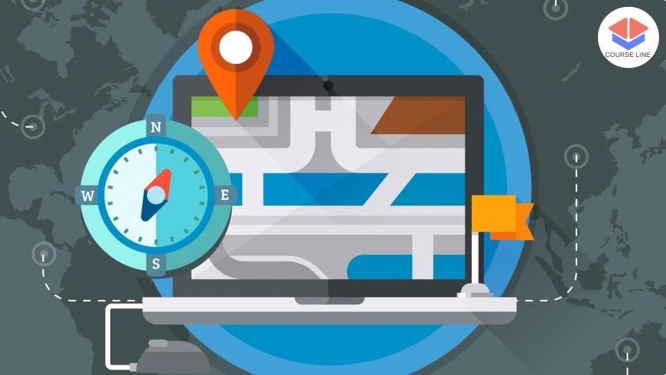
The Cartography and Visualization course is designed to provide students with the skills and knowledge to understand, create, and interpret maps in the context of geographical information science (GIS). Starting with a solid introduction to GIS and the role maps play in spatial analysis, the course delves into the essential components of cartography, including data acquisition, map characteristics, and the various tools and techniques used to collect and visualize spatial data. Students will gain an understanding of the different types of maps, including topographic, statistical, and flow maps, and when each type is appropriate to use in different contexts.
The course also explores the complexities of flow mapping and projections, crucial for accurately representing the Earth's surface on flat maps. Learners will understand how different projections affect the depiction of geographical features, providing them with the skills to select the appropriate projection for various mapping tasks. A detailed focus on topography will allow students to create maps that accurately represent natural and man-made features on the Earth's surface, while the statistical mapping module will equip students with the ability to visualize data trends geographically.
Understanding how to map time is another critical aspect of the course, helping learners visualize changes over time, which is essential for applications like urban planning, environmental monitoring, and historical analysis. The final module focuses on the practical aspects of cartography, teaching students how to present and use geospatial data in maps and atlases effectively. By the end of the course, students will have the skills to create visually compelling and accurate maps, along with the ability to interpret geospatial data for a wide range of practical applications.
Who is this course for?
The Cartography and Visualization course is designed to provide students with the skills and knowledge to understand, create, and interpret maps in the context of geographical information science (GIS). Starting with a solid introduction to GIS and the role maps play in spatial analysis, the course delves into the essential components of cartography, including data acquisition, map characteristics, and the various tools and techniques used to collect and visualize spatial data. Students will gain an understanding of the different types of maps, including topographic, statistical, and flow maps, and when each type is appropriate to use in different contexts.
The course also explores the complexities of flow mapping and projections, crucial for accurately representing the Earth's surface on flat maps. Learners will understand how different projections affect the depiction of geographical features, providing them with the skills to select the appropriate projection for various mapping tasks. A detailed focus on topography will allow students to create maps that accurately represent natural and man-made features on the Earth's surface, while the statistical mapping module will equip students with the ability to visualize data trends geographically.
Understanding how to map time is another critical aspect of the course, helping learners visualize changes over time, which is essential for applications like urban planning, environmental monitoring, and historical analysis. The final module focuses on the practical aspects of cartography, teaching students how to present and use geospatial data in maps and atlases effectively. By the end of the course, students will have the skills to create visually compelling and accurate maps, along with the ability to interpret geospatial data for a wide range of practical applications.
Requirements
The Cartography and Visualization course is designed to provide students with the skills and knowledge to understand, create, and interpret maps in the context of geographical information science (GIS). Starting with a solid introduction to GIS and the role maps play in spatial analysis, the course delves into the essential components of cartography, including data acquisition, map characteristics, and the various tools and techniques used to collect and visualize spatial data. Students will gain an understanding of the different types of maps, including topographic, statistical, and flow maps, and when each type is appropriate to use in different contexts.
The course also explores the complexities of flow mapping and projections, crucial for accurately representing the Earth's surface on flat maps. Learners will understand how different projections affect the depiction of geographical features, providing them with the skills to select the appropriate projection for various mapping tasks. A detailed focus on topography will allow students to create maps that accurately represent natural and man-made features on the Earth's surface, while the statistical mapping module will equip students with the ability to visualize data trends geographically.
Understanding how to map time is another critical aspect of the course, helping learners visualize changes over time, which is essential for applications like urban planning, environmental monitoring, and historical analysis. The final module focuses on the practical aspects of cartography, teaching students how to present and use geospatial data in maps and atlases effectively. By the end of the course, students will have the skills to create visually compelling and accurate maps, along with the ability to interpret geospatial data for a wide range of practical applications.
Career path
The Cartography and Visualization course is designed to provide students with the skills and knowledge to understand, create, and interpret maps in the context of geographical information science (GIS). Starting with a solid introduction to GIS and the role maps play in spatial analysis, the course delves into the essential components of cartography, including data acquisition, map characteristics, and the various tools and techniques used to collect and visualize spatial data. Students will gain an understanding of the different types of maps, including topographic, statistical, and flow maps, and when each type is appropriate to use in different contexts.
The course also explores the complexities of flow mapping and projections, crucial for accurately representing the Earth's surface on flat maps. Learners will understand how different projections affect the depiction of geographical features, providing them with the skills to select the appropriate projection for various mapping tasks. A detailed focus on topography will allow students to create maps that accurately represent natural and man-made features on the Earth's surface, while the statistical mapping module will equip students with the ability to visualize data trends geographically.
Understanding how to map time is another critical aspect of the course, helping learners visualize changes over time, which is essential for applications like urban planning, environmental monitoring, and historical analysis. The final module focuses on the practical aspects of cartography, teaching students how to present and use geospatial data in maps and atlases effectively. By the end of the course, students will have the skills to create visually compelling and accurate maps, along with the ability to interpret geospatial data for a wide range of practical applications.
-
- Geographical Information Science and maps 00:10:00
-
- Data acquisition 00:10:00
- Map characteristics 00:10:00
- Exam of Cartography and Visualization 00:50:00

No Reviews found for this course.
Is this certificate recognized?
Yes, our premium certificate and transcript are widely recognized and accepted by embassies worldwide, particularly by the UK embassy. This adds credibility to your qualification and enhances its value for professional and academic purposes.
I am a beginner. Is this course suitable for me?
Yes, this course is designed for learners of all levels, including beginners. The content is structured to provide step-by-step guidance, ensuring that even those with no prior experience can follow along and gain valuable knowledge.
I am a professional. Is this course suitable for me?
Yes, professionals will also benefit from this course. It covers advanced concepts, practical applications, and industry insights that can help enhance existing skills and knowledge. Whether you are looking to refine your expertise or expand your qualifications, this course provides valuable learning.
Does this course have an expiry date?
No, you have lifetime access to the course. Once enrolled, you can revisit the materials at any time as long as the course remains available. Additionally, we regularly update our content to ensure it stays relevant and up to date.
How do I claim my free certificate?
I trust you’re in good health. Your free certificate can be located in the Achievement section. The option to purchase a CPD certificate is available but entirely optional, and you may choose to skip it. Please be aware that it’s crucial to click the “Complete” button to ensure the certificate is generated, as this process is entirely automated.
Does this course have assessments and assignments?
Yes, the course includes both assessments and assignments. Your final marks will be determined by a combination of 20% from assignments and 80% from assessments. These evaluations are designed to test your understanding and ensure you have grasped the key concepts effectively.
Is this course accredited?
We are a recognized course provider with CPD, UKRLP, and AOHT membership. The logos of these accreditation bodies will be featured on your premium certificate and transcript, ensuring credibility and professional recognition.
Will I receive a certificate upon completion?
Yes, you will receive a free digital certificate automatically once you complete the course. If you would like a premium CPD-accredited certificate, either in digital or physical format, you can upgrade for a small fee.
Course Features
Price
Study Method
Online | Self-paced
Course Format
Reading Material - PDF, article
Duration
1 hour, 45 minutes
Qualification
No formal qualification
Certificate
At completion
Additional info
Coming soon
- Share

Aerospace Engineering Level 5 Advanced Diploma
Course Line247£490.00Original price was: £490.00.£14.99Current price is: £14.99.Supply Teacher Level 3 Advanced Diploma
Course Line239£490.00Original price was: £490.00.£14.99Current price is: £14.99.ENT Level 8 Advanced Diploma
Course Line246£490.00Original price was: £490.00.£14.99Current price is: £14.99.